https://www.perrinremonte.com/home-bis
Lower res version with updated scale

https://www.perrinremonte.com/expe-eng?itemId=m21a3at8pndyfg97b4lgs89eem8gg4
https://www.perrinremonte.com/home-bis
Lower res version with updated scale

https://www.perrinremonte.com/expe-eng?itemId=m21a3at8pndyfg97b4lgs89eem8gg4
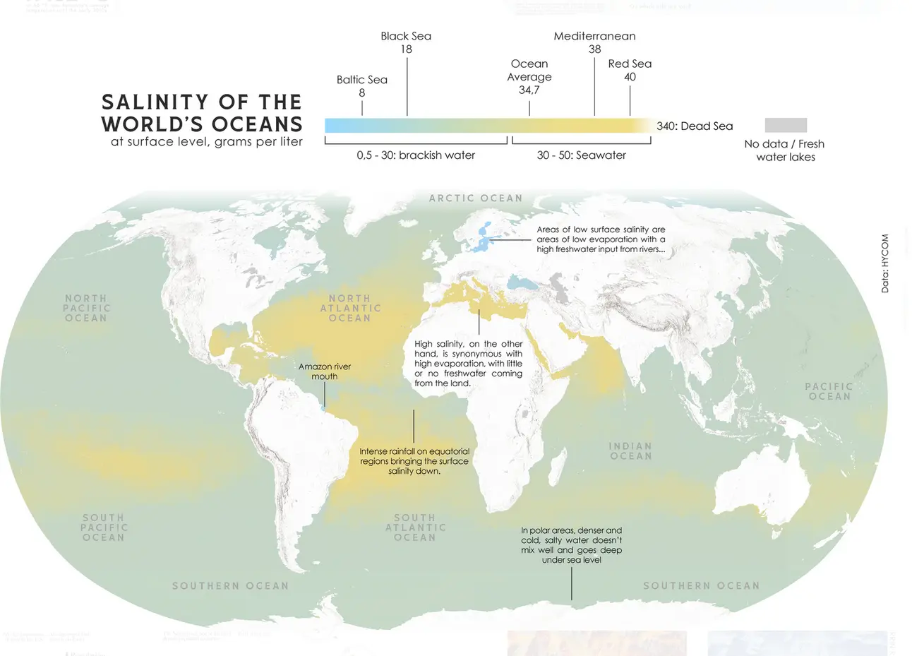
I’m surprised that the effect of major rivers is big enough to be visible on a global map, at least in otherwise saline areas (Amazon, Mississippi, Congo?). Interestingly, the world’s longest river (Nile) which drains into one of the saltiest seas (Mediterranean) doesn’t register on this scale at all.
The Nile’s average volume is not actually all that big. The Amazon puts more than 70 times as much water into the ocean, apparently. Although the Amazon is quite an outlier in that regard, being about as big as the 2nd through to 7th largest combined
I don’t understand how the Mediterranean shows as mustard on the map while on the scale its marked as green.
They fixed it in the meantime
https://www.perrinremonte.com/expe-eng?itemId=m21a3at8pndyfg97b4lgs89eem8gg4
Cool - i love updates with more sense